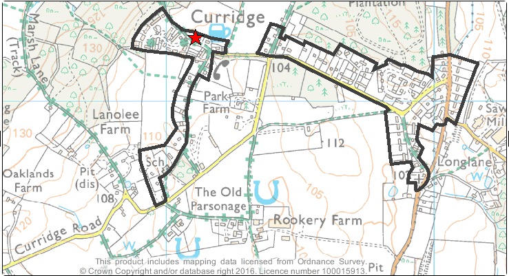
The current settlement boundary for Curridge is shown within the two distinct black outlines on the map above (taken from WBDC website, November 2016). The settlement boundary defines the external limit of the area where further residential development may normally be considered.
It does not necessarily encompass all of the existing domestic properties, but gives an indication of the agreed area(s) of the village in which further development may be permitted in the future, subject to the other planning criteria being met.
If a development is proposed outside of the settlement boundary, including directly adjoining the existing boundary, then special circumstances will have to be demonstrated by the planning applicant to justify the development outside of the settlement boundary.
